Last Stop in South America – Ecuador – Quito, Banos, Cuenca and Guayaquil

So that inevitable day has come;  I have finally ran out of money. The end of money spells the end of my six month trip passing through fifteen countries by the time I step back afoot on native soil, and unfortunately my very last stop in South America was a small country called Ecuador.

IMG_4896.JPG

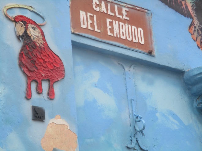
Named, funnily enough, because of its position on the equator, Ecuador has a friendlier, safer feel than its Colombian neighbour; evidently this rather small country was not so badly hit by narcoterroism, the poverty is still rife here, as it has been through pretty much all of the Latin American countries I have visited.

IMG_4900.JPG

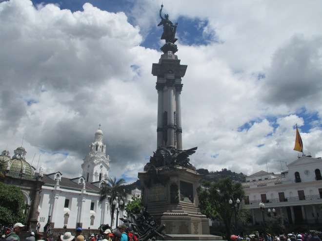
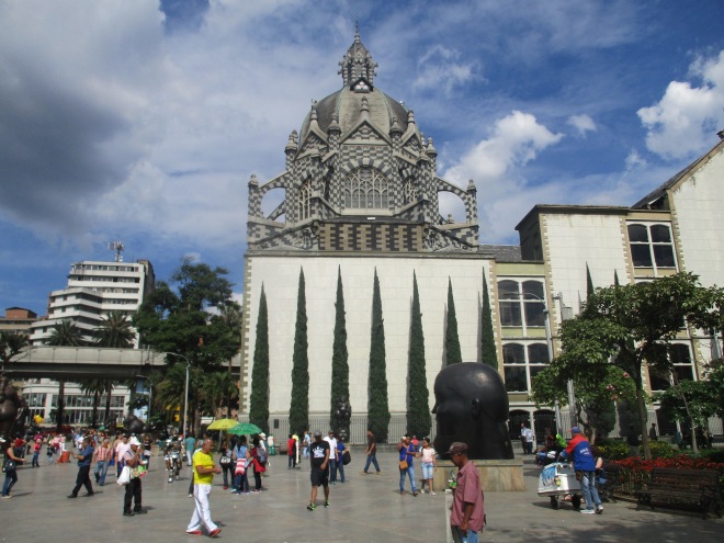
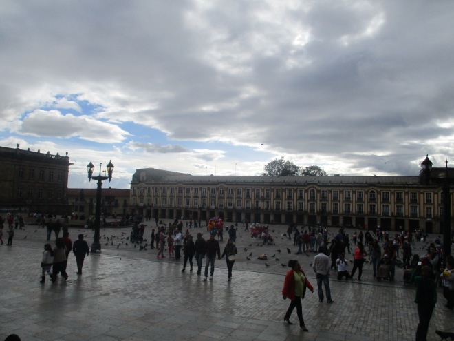
The capital city of Quito pleasantly surprised me, and was one of the most agreeable capitals I have visited throughout my six months. It is larger than expected, and many hostels are situated in the New Town, a surprisingly trendy area with many bars, restaurants and discotecas (I read in my guide book that “club” actually means a brothel in this city, so I shall refrain from using the term…).

IMG_4907.JPG

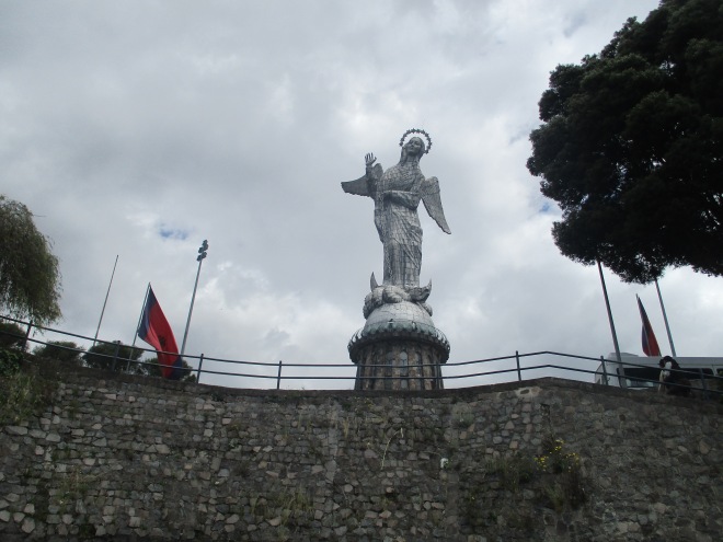
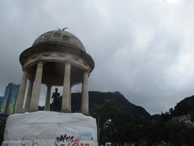
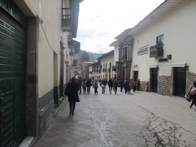
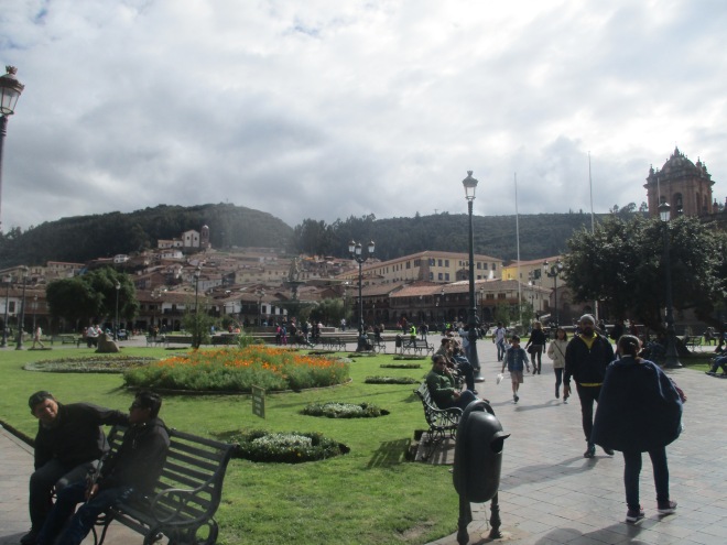
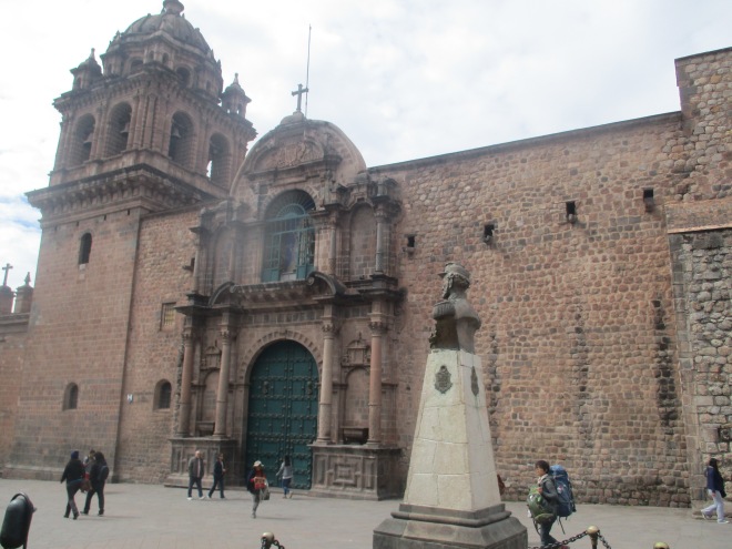
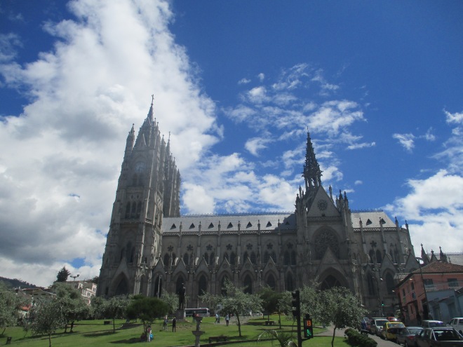
The Old Town is brimming with hilly cobbled streets, beautiful architecture and the inevitable churches and squares. A short walk up a hill brings you to the largest aluminium statue worldwide; one of an angel called     , with fantastic views of the city.

IMG_4932.JPG

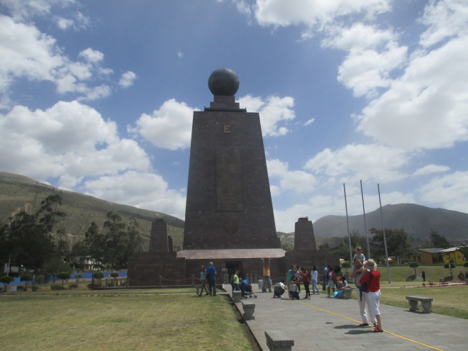
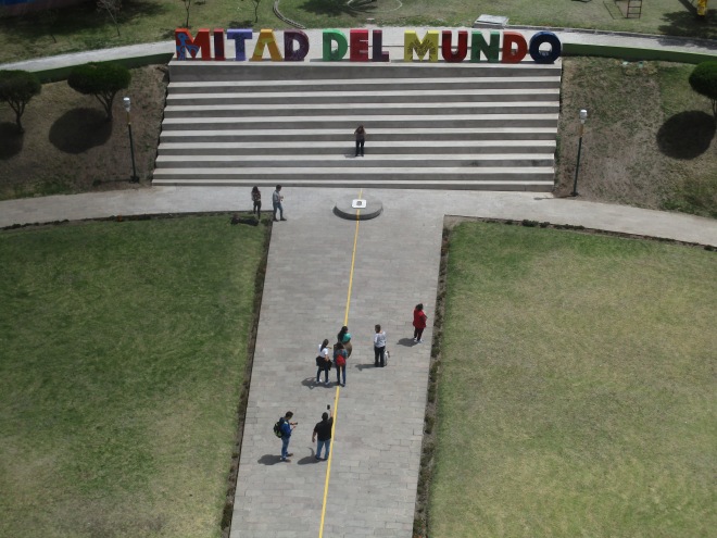
A well worthwhile day-trip from Quito is one to El Mitad del Mundo (literally the middle of the world), a monument and museum upon which the Equator lies. The monument is huge, and it’s quite fun jumping from one hemisphere to the other. Furthermore, the museum is interesting and busts certain myths such as the one of water running different ways down the tap hole – the flow of water is actually reliant on a number of factors and can be manipulated to flow any way you like in any hemisphere.

IMG_4941.JPG

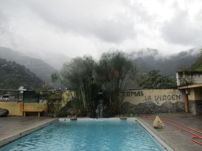
Banos is a sweet town around a four hour journey from Quito. The translation of the town’s name means “baths” and is so called because of the thermal springs, teeming with minerals, which the city hosts. These baths are very relaxing, though can get busy on weekends and public holidays. Banos has a lot of outdoor activities available also, and the luscious green landscape surrounding enhances the stay in the town.

IMG_4978.JPG

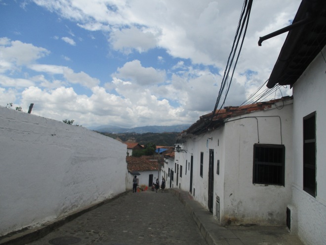
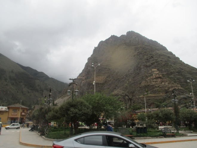
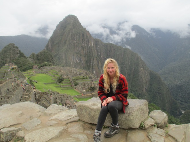
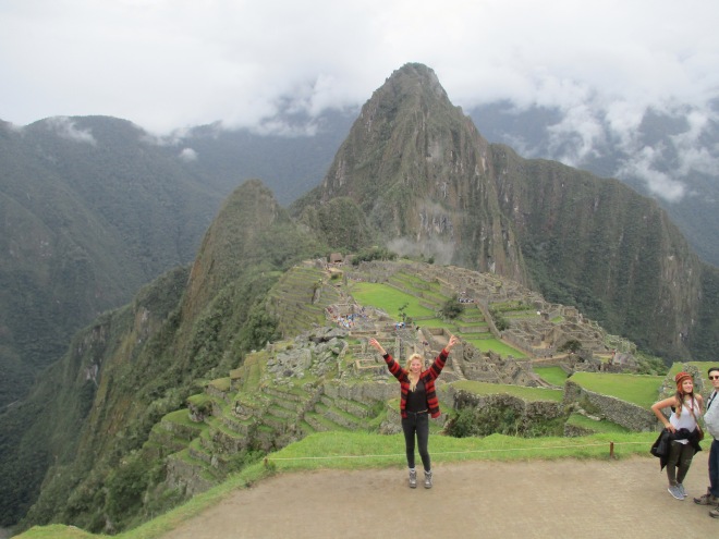
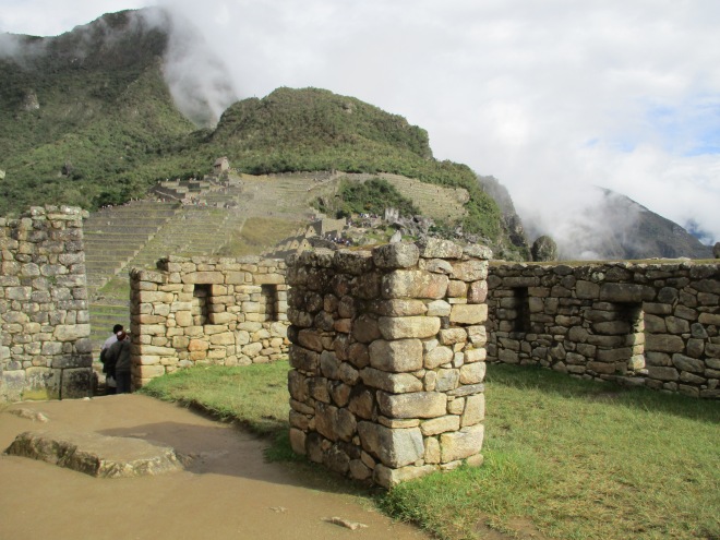
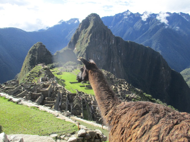
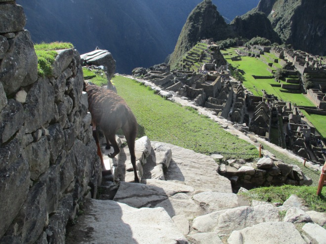
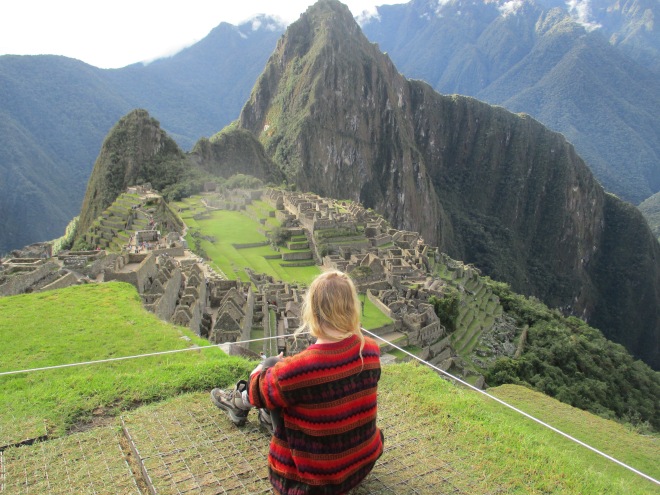
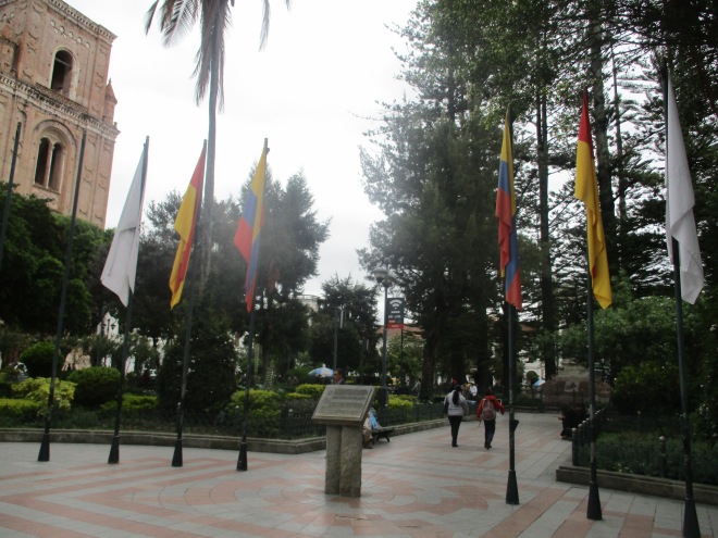
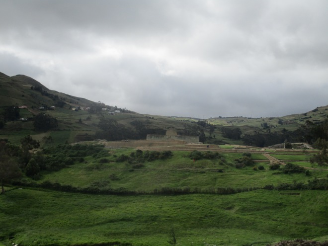
Another night bus, and an arrival at Cuenca, yet another colonial town, this time situated in the Central Highlands of the country. Token features include a church and main square, and there’s also a pleasant river. This town acts as a base to visit Ecuador’s most well-preserved Incan ruins, Ingapirca, around a two hour journey from the bus terminal. With a landscape reminiscent to the English countryside, this site has the only remaining Sun Temple left intact throughout the Incan Empire and entrance includes a tour.

IMG_5002.JPG

It was a last, tiring nightbus which brought me to the coastal town of Guayaquil. Lacking the small town charm of some of the other places I have visited in Ecuador, Guayaquil is a bustling city. It’s central park differs a little from the now unfortunately familiar formula of the rest of the colonial centres; this one has iguanas and terapins in! A walk along the malecon is recommended, and the town’s ferris wheel aloft on the banks of the large river a beautiful lit up by night. The neighbourhood of Las Penas consists of a hill leading up to a chapel and lighthouse, making for a very good view across the town.

IMG_5023.JPG

So it is from here, Guayaquil, that I take a flight which stopsover in Panama and finally ends up in Havana, Cuba. This experience I am very much looking forward to and fascinated by. However, I can only spend five short days in Cuba before catching a flight to the hopefully embargo-free Florida and finally getting that across-Atlantic journey to London.

It has been a long first journey. Travelling away from home for six months has truly been eye-opening. I have adored experiencing the wealth of different cultures, landscapes, city architectures and characters of people along the way.

I have sampled strange and interesting foods, conversed with strange and interesting people, seen so many beautiful ruins of civilisations almost completely wiped out by colonisers, climbed volcanoes, trekked through jungles and traveled the furthest away from home as I have been so far.

Though it hasn’t been all bright, sunny and full of sprouting daisies the whole time, I feel as though I have come out the other side of this journey someone more enriched, culturally aware and furthermore enlightened about the struggles that go on beyond the small country which I call home.

No doubt I will be back to travel South America when I can – so many more nations still need to be conquered! But for now, I shall have to return home, recuperate funds and set my sites on another wonderful continent for my next big trip; the beauty of Asia awaits me.

Cartagena, Medellin, Guatape, Coffee Country and Cali

Just along the coast from Santa Marta is the beautiful fortified city of Cartagena. You can actually walk on top of these walls overlooking the sea, which is quite a sight, and all the buildings are sweetly colonial. These a nice set of market stalls under arches just across from the clock tower which sell sickeningly sweet treats; the fudge block shaped like a baby was delicious/


Moving away from the coast, one reaches an area that little-less than thirty years ago was fiercely controlled by gangs.

IMG_4808.JPG

Medellin in particular was badly affected by narcoterroism, having been the home of infamous drug lord Pablo Escobar. Nowadays, Medellin isn’t considered quite as dangerous and parts of the city, namely the trendy El Poblado, full of hip open front bars and stunningly dressed young people, are even quite nice to stay. You can still visit Escobar’s grave and the rooftop on which he was shot. Beware, not all the facts in the TV series “Narcos” are correct, though certain parts, such as his brutality to blow up a plane just to get at one person, are true. Furthermore, it is the fault of Escobar that wild hippos roam the hills just outside Medellin, as they escaped from his mansion which featured a menagerie of the sorts.

IMG_4825.JPG

The centre is still a little rough in comparison, but hosts a lovely square full of fat sculptures of various animals and people created by the artist Botero.

IMG_4769.JPG

A couple of hours out from the north terminal of Medellin and you reach the beautiful countryside surrounding Guatape. This area is dominated by a huge rock; El Penol. This isn’t so strenuous to climb up the 700 or so zig-zagging steps, and the view of the eerie lake complex and woodlands beyond is more than worthwhile.

IMG_4785.JPG

Coffee country was next – onwards to a Finca just outside Manizales where we were able to sample different types of coffee grown in the beautiful mountainous scenery and have a look at the factories, then to Salento, a pleasant little town known for its hiking, but where pleasant fresh water trout is also on the menu.

IMG_4853.JPG

One of the last stops in Colombia was Cali, yet another city badly affected by drug trafficking, due to the Cali Cartel. Though much of the town is still a bit… rustic, the San Antonio area is nice to stay in, especially walking up the grassy hill just beyond which had a number of music acts, food vendors and dog shows when I was there.


A quick stop in the colonial town of Popayan and it was a night bus to Ipiales, the border town. Onwards to Ecuador then!

Santa Marta and the Ciudad Perdida Trek

Another night bus to the coast and I found myself in the very Caribbean feeling Santa Marta. Next to the coast, this industrial town with a huge port isn’t exactly known for its beaches, though Parque Tayrona further up the coast is a bit more equipped for the idyllic beach scene.

IMG_4534.JPG

The main reason for coming here, apart from staying in an awesome hostel with a mango tree, was to go on the Ciudad Perdida trek.

IMG_4612.JPG

This was honestly one of the highlights of my entire journey. I love trekking, and the coastal, jungle terrain of Colombia made the perfect spot for diverse wildlife, towering jungles trees and crystal blue rivers which we got to swim in. The Ciudad itself is quite modest, with platforms of circular grassy discs rising up on the side of the mountain. Indigenous people still live there and go up and down the trails with mules.


The food provided by the tour was excellent too, with fruit stops every so often which hosted the best tasting pineapple I’ve had.


Colombia – Bogota, Bucaramanga and Giron

So Colombia’s capital city is an interesting stay…

IMG_4372.JPG

I arrived after about two days of dodgy sleep; a night bus from Arequipa to Lima and an early early morning flight to Colombia.

IMG_4373.JPG

A public bus from the airport took me straight to La Candelaria, the main central part of town. Here you’ll find a square full of people putting seeds on their sleeves to get a photo of them being stormed by pigeons. Furthermore, the Military Museum is free and interesting to look around – details of the famous drug-fueled war between the government and paramilitaries are exhibited as well as some more historical weapons and uniforms, complete with a helicopter and missiles in the back garden.

IMG_4374.JPG

As a vegetarian, I fell in love with a Colombian food which I expect a lot of people might find quite bland; the Arepa. Essentially a pancake made out of maize (though I swear some of the ones I have had were made out of potatoes…) the best ones come with butter and grated cheese.

IMG_4389.JPG

Another activity worth promoting in Bogota is the Graffiti Tour. Run by a very sound-minded young American-Colombian, the tour took me through some previously undiscovered cobbled streets and highlighted some of the wonderful street art the city had to offer – both aesthetic and political.

IMG_4383.JPG

The walk up to Monserat – the monastery on top of the hill overlooking the town – is well worth it, though it can be a bit strenuous on the thighs. Several hundreds of steps take you up to the summit where the most amazing view of Bogota is seen. For those who’d prefer not to take the steps, there’s also a cable car to take you both ways.

IMG_4399.JPG

A tiny security warning for Bogota (and the majority of big cities in Colombia and South America in general in fact), be careful walking alone at night and be aware of certain areas. Myself and a guy I was with were threatened with a knife near the centre. Just be wary.

From Medellin, a lot of backpackers make their way to Villa de Leyva or San Gil for some extreme sports. We, however, headed out to Bucaramanga for something that can only be described as an “authentic” Colombian experience. Essentially there’s not much to do here and the main street of the city is a shopping street filled with open front shops selling what can only be described as tat. The highlight of Bucaramanga was the dessert cafe next to our really cheap hostel. But before, the South Americans have an odd set of taste buds and they seem to think it’s perfectly normal to add grated cheese to an ice cream sundae. The Crema de Avena drink is heaven in a cup however, though by no means helped with my attempted travelling diet. Try coffees that street vendors sell in flasks too, they’re really cheap.

IMG_4432.JPG

Less than an hour’s bus ride from Bucaramanga was a lovely colonial town called Giron, with a mountain setting, central square and unique cathedral.

Llama or Alpaca?

Probably the biggest and most important question which had been raised in my mind over the two weeks I have been in Peru is how you can tell the difference between a llama and an alpacaca.

And google returns some very interesting results.

  1. So one of the main differences between the two is the ear shape. Apparently llamas have long, banana-shaped ears whereas alpacas have very short thin ones
  2. Furthermore, alpacas are the smaller ones and llamas are generally much larger.
  3. Llamas faces are longer and alpacas shorter and more cutesy cramped
  4. Alpacas wool can be used in textiles whereas llamas aren’t so fortunate and are more likely to be used for farm labor and meat
  5. Alpacas are herd animals and llamas are very strong independent individuals


Basically llamas are larger and spit more. Another important question answered. You are welcome.

Arequipa Peru

Looping back up into Peru, I arrived in the beautiful town of Arequipa. Surrounded by snowcapped mountains and with a delightful centre square, cathedral and being home to the 16th century Santa Catalina monastery, the place is picturesque to say the least.

IMG_4357.JPG

It is a good town to base yourself if you wish to visit Colca Canyon – the world’s deepest canyon about 150km north of the town, and companies run regular tours ranging from multiple day hikes to a day trip.

IMG_4348.JPG

The market here is delightful with a range of traditional foods being offered, such as ceviche, the vegetarian option of some layered potato thing (it was actually very tasty!) and also stuffed peppers which unfortunately had meet in them. The juice here is great to try too.

IMG_4354.JPG

Lake Titikaka, Copacabana and La Paz, Bolivia

Lake Titikaka is enormous and stunning. By sheer volume of water, it is the largest lake in South America and forms part of the border between Bolivia and Peru.

IMG_4258.JPG

I went to Copacabana from Cusco ny night bus, passing through quite an easy border control to find myself in the small Bolivian town. My main reason for visiting Copacabana was to head to the Islas de Sol y Luna – two islands which were beleived by the Incas to be the birthplaces of the sun and the moon.

IMG_4259.JPG

The boat out of Copacabana was cheap and very rickety. There are waves on this lake, and big ones, so it’s probably not advisable if you get sea sick. Honestly, the islands are just islands, but it was nice having a walk around them, especially when it was sunny.


Back on mainland and I took a collectivo from Copacabana to La Paz.

IMG_4322.JPG

Once again I have to be honest with you here; I did not like La Paz. The highest recognised capital in the world, the Bolivian city’s altitude made me feel quite dizzy, the weather was so grey and horrible that I was unable to see the famous Mount for the time that I was there. Perhaps a trip down Death Road would have cheered me up, but with the trusted tour guides charging over $100, such a thing wasn’t possible.

IMG_4335.JPG


So I was cold and grumpy, and thought I would cheer myself up by going to the curious sounding “Witches Market”. But, oh god, there were dead llama foetuses hanging off the walls!

IMG_4338.JPG

It could probably go unwritten that I got out of there as soon as I could.

Cusco, Ollataytambo and Machu Picchu

A night bus from Nazca and I arrived in the old Inca city of Cusco. Now the place is a sprawling metropolis, with busy roads and industrial block buildings on the outskirts. The old city, however, was a very pleasant place to spend a couple of nights and was always buzzing with activity.

IMG_3826.JPG

Anyone making the visit to the world-renowned Machu Picchu will probably stop here for a day or two. The place is close to a number of Incan ruins, such as Saqsaywaman (I thought some guy was saying “sexy woman” to me when I first heard this…) sitting high up on a western hill. Furthermore, though the centre is now full of colonial buildings constructed as a result of the Spanish, there still remains some examples of Incan architecture. The town is also said to have been built in the shape of a jaguar, which I was sceptical about until I saw a birdseye view showing how the two rivers of the city and the great hill of Saqsaywaman form the body and the head respectively.

IMG_3829.JPG

The San Pedro market is worth a look. Stalls and stalls sell “real” alpaca wool jumpers, cute llama keyrings, shot glasses, and every other souvenir which you may desire. I was quite proud of my jumper that I bought with llamas on and ended up wearing it for three days straight. Furthermore, the food hall part offers a chance to sample local foods at very reasonable prices – I forewent my full vegetarian diet for the first time in months, reverting back to my pescetarian state to sample some local ceviche, which was very tasty.

IMG_3838.JPG

You will randomly see women dressed in colonial clothing holding tethers to alpacas or even lambs on the cobbled streets. On Sunday too, in the Plaza de Armas, there was a great display of masked men and women dancing which was very interesting to watch.

IMG_3821.JPG

An hour and a half collective ride and I found myself deep in the midst of The Sacred Valley in a sweet Incan town called Ollataytambo. The scenery here is stunning; epic green mountains rise either side of the road and village, acting as huge, natural walls against the outside world. Be careful of stray dogs in this town – one certainly took a liking to me and followed me wherever I went, which wouldn’t have been so concerning if other dogs weren’t growling and the issue of rabies wasn’t constantly alit in my mind. Ollataytambo hosts its own Incan ruins and is also a place to get the railway train to Agua Calientes and on to Machu Picchu.

IMG_3882.JPG

I had a massive debate with myself about getting to Machu Picchu. The train tickets can be purchased through two companies; Perurail and Incarail. Both, however, are extortionately expensive, with one way tickets costing $50 and up. Purchasing such a ticket would be such a detriment to my budget, and I was even considering walking the railway tracks as some other blogs suggest until I came across one where a lady had been bitten by a dog. Being on my own, and not the best at dealing with blood, I’m not sure how I would have coped!

IMG_3890.JPG

Some people from my hostel in Cusco had opted for 3-4 day treks, a lot of them alternatives to the Inca Trail. Again, guided tours are not cheap, and although some people made the journey on their own, the thought of hiring camping equipment, being alone and therefore quite vulnerable if anything happened to me and the fact that my hiking experience only stretches to the Welsh and English countrysides – very different from the high-altitude trails I would have to tackle – I was put off.

IMG_3891.JPG

So train it was, although I felt then, and still now, a wimp for taking the soft and easy option. I did forgo the $9 bus from Agua Calientes up to Machu Picchu though, meaning that I got some walking done by scaling the stone steps about 1000 metres or so.

IMG_3905.JPG

Anyway, on to Machu Picchu itself.

The Inca Citadel is certainly breathtaking to behold. Balanced precariously on the mountainside with the imposing Huaychina Picchu mountain rising beyond, the place feels almost mystical and unreal to view.

IMG_4085.JPG

The site is so well-known because, unlike other Incan strongholds, the citadel was left untouched by the Spanish, who pretty much ransacked and destroyed every other part of the civilisation when they colonized. Sources vary as to whether the Spanish knew Machu Picchu was there or not, but if they did then they never reached it.

IMG_4086.JPG

The site was first brought to the attention of the Western world when American explorer and archaeologist Hiram Bingham (he now has a special route on the Perurail railway named after him) ventured to Peru in 1911 and was shown to the site by a twelve-year-old farmer’s son for 1 sol.

IMG_3977.JPG

Further expeditions were made and over the 20th century the place was awarded the title of “One of the Seven New Wonders of the World” and also hyped up to be the tourist destination it is today.

IMG_4070.JPG

Entrance tickets themselves cost around $40 and can be purchased online at the Ministerio de Cultura. The code you receive upon purchase can then be exchanged at the ticket office in Agua Calientes for a ticket.

IMG_4042.JPG

The site has a number of trails you can follow, one around Machu Picchu mountain and also another leading to the Incan drawbridge – a set of wooden planks indented into the side of a sheer mountain-face. The latter walk takes around 15 minutes, but is not advised for those scared of heights as sheer drops and narrow paths are present along the way. The track does give a spectacular view over the mountain. Likewise it is possible to scale. Huayna Picchu, though the number of people allowed each day is limited and must be bought well in advance. Looking two weeks ago at the beginning of May, I saw that it was booked up right to September. Similar occurrences happen with the Inca Trail if you are in a more fortunate financial situation thatn me and are able to fork out the $400 for the trail permit. Watch your step on all trails and places around the site – especially if it’s raining like part of the day which I visited on – they become very slippy.

IMG_4160.JPG

Obviously the place is a great site for photo opportunities and there are even a number of resident llamas who are happy to say hello.

IMG_4204.JPG

The city itself consists of a main plaza, some beautifully preserved residential houses, a number of temples and sprawling steps of land spilling off the mountainside which was used for agriculture. Interestingly, as I overheard from a tour, most of the seed remnants were recovered on the Eastern side of the mountain, where the crops would have got the maximal amount of sun for them to grow properly.

IMG_4205.JPG

There’s also the Sacred Rock right at the other side of the site – a huge rock thought to have been used for religious purposes and flanked by two roofed huts (one which even has a bench!) which makes a great dwelling for when it rains. The large rock is shaped like the mountains beyond it and is said to give you energy if you touch it – something I sadly forgot to do when I was having an energy dip.

IMG_4137.JPG

So all-in-all, although it ruined my travel budget and my pride as a hiker, I am glad to have visited this magnificent site, a true lost city touching the clouds. And after all, in fifty or so years time, it won’t be the money I spent that I will remember, it will be that beautiful light which illuminated the stunningly placed sharp rock above some of the sole in-tact ruins of a great society of humanity, just as the rain clouds cleared and the bright, dazzling and much-appreciated sun appeared.

IMG_4213.JPG

Viva Peru! Lima, Huacachina and Nazca

So, after a pretty uncomfortable night spent sleeping on the floor of Mexico City airport, I got the six hour flight I had booked a month and a half ago to Lima.

IMG_3665.JPG

I only spent one night in Lima; I will be passing rough here to go to Colombia in two weeks so I figured I could get a better taste of the city then. From what I saw though, Miraflores was a very nice, happening place, especially around Parque Kennedy. There are a lot of bars and restaurants and a nice buzz at night. Or maybe I was just influenced by the fact that the supermarket close to there sold super-cheap focaccia…

IMG_3672

Parque Kennedy in Miraflores, Lima

Anyway, I managed somehow to take public transport to the Cruz del Sur terminal in the city. The receptionist recommended me this company, and although it’s cheap with a good service on the bus, I had to wait 50 minutes in the terminal just to book my tickets! Also, the cheapo in me wouldn’t mind taking more Soyuz buses to save that all-important cash.

IMG_3675

View from the bus

Huacachina is an oasis town just outside of the city of Ica. To get there, one must take the bus to Ica and then go by taxi or motortaxi (motortaxi is cheaper, and quite a fun ride!).

IMG_3697

IMG_3688.JPG

To be honest, I’m not really sure what to think of the place. Climbing the sand dune was an experience, and you are able to book dune-buggy and sandboarding tours (though thanks to the little-known site of Machu Picchu draining all my funds, I had to give these a miss). But apart from that, the place lacked atmosphere for me and I couldn’t really have stayed there more than the one night. I guess it was good to get a look at the oasis though, and it might sound stupid, but I really didn’t expect Peru to have desert.

IMG_3705.JPG
View out into the desert 

Anyway, another day, another bus, this time arriving in the southern town of Nazca. Again, the town itself lacked an atmosphere for me which I have appreciated in a number of other places through my travels, though the central square is nice to sit in and have a muse.

IMG_3729.JPG
Central Square in Nazca

The real draw to the town of Nazca is the famous Nazca lines. Around 80 of them are depicted as artistic shapes representing animals and religious emblems, such as trees, carved into the dry desert terrain between Ica and Nazca. Thought to have had some spiritual significance, maybe even corresponding to constellations, the lines were thought to have been made around 540AD and have been preserved so well as a result of the climate and stable conditions in the area.

IMG_3801
El Arbol Nazca line
IMG_3790
Me at the top of the viewing tower

If you have el dinero, one can participate in an aircraft tour; where a lightcraft plane gives you the best views of the spectacular works. I, however, sadly on such a strict, peasants budget, opted for the viewing tour, or mirador, which costed 3 soles (1 dollar) to ascend, with the bus two and fro also being three dollars each time. You get a good look at el arbol y los manos, so I would say it was worth it, especially as the place was crowned a UNESCO World Heritage Site in 1994 (a fact a purely remember because it also happens to be the year of my birth!).

IMG_3804
The mirador for viewing